Paris Along the Seine: Left Bank from Saint-Cloud to Bercy
Paris Along the Seine: Left Bank from Saint-Cloud to Bercy
The Seine, from the inside. Not the postcard view from above, not the Pont-Neuf as a screensaver background. No — the Seine seen from the handlebars, at water level, with bridges filing past one by one like pages of a book you never want to finish. From Saint-Cloud to Bercy, the left bank offers one of the most complete cycling routes in Île-de-France. Around 20 kilometres. Two hours if you stop, three if you really take your time.
Samir K. did it on a Tuesday morning at 7:30. Zero joggers, zero pushchairs. Just the Seine, a few seagulls and some fishermen. Here’s everything you need to know before setting off.
The Route, Section by Section
From Saint-Cloud to Pont de Sèvres: warming up
You start on the left bank from the Parc de Saint-Cloud, on the Sèvres side. The path follows the lower riverbank — tarmacked, clean, straightforward. It’s easy cycling — flat, no crossings with motor traffic, with the Seine glittering to your right. The first section, as far as Pont de Sèvres, is about 3 kilometres. It’s entirely reserved for cyclists and pedestrians. No traps whatsoever.
Note: at Pont de Sèvres, you need to briefly rejoin the road to bypass the A13 motorway interchange. This detour is about 400 metres — a bit ugly, but perfectly manageable.
From Pont de Sèvres to Pont de Grenelle: the heart of the route
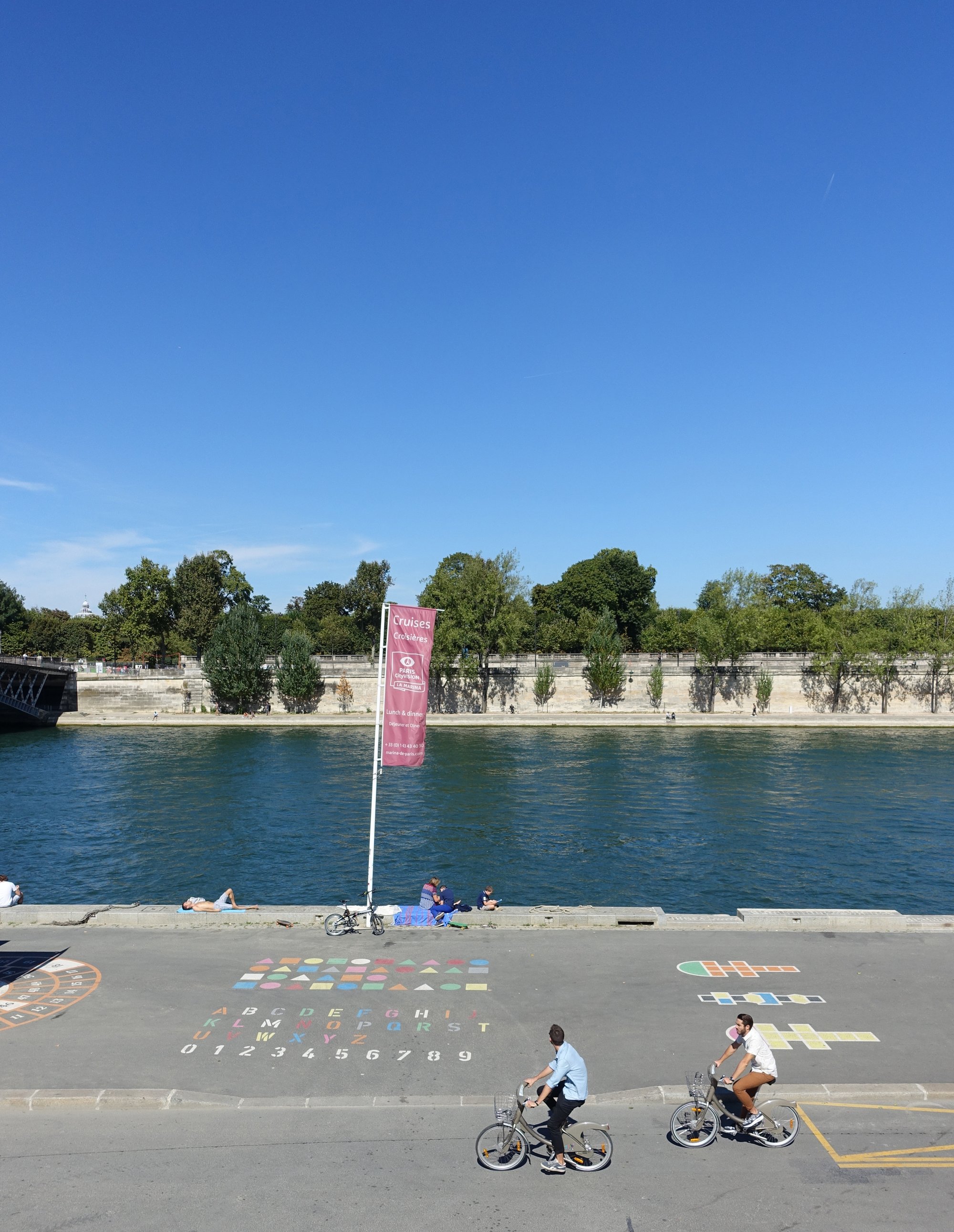
This is where things get serious. The lower riverbanks of the Seine — the famous Voies sur Berges — open up across several kilometres of car-free tarmac. This is where the Paris Berges project truly comes into its own. The City of Paris permanently pedestrianised (and opened to cyclists) the left-bank riverbanks between the Champ-de-Mars and the Trocadéro in 2016, as part of the Seine riverbank redevelopment scheme.
The passage under Pont de Grenelle deserves a special mention. Most bridges are passable by bike — the arch is high enough, the surface stays smooth even after rain. But the downstream side of Pont de Grenelle has a pedestrian/cyclist convergence zone that can get tricky at weekends. Slow down, look up, smile at people.
The Île aux Cygnes — a narrow artificial island in the middle of the river — is visible from this section. You can access it from Pont de Grenelle: a small 850-metre loop with a replica of the Statue of Liberty at its tip. Optional, but a great bonus for any tourists along for the ride.
From Pont de Grenelle to Pont d’Iéna: the Eiffel Tower effect
Inescapable. It appears between two trees when you least expect it. The Eiffel Tower backlit, with the Seine in the foreground — this is the number one photo spot on the route. Stop at the Champ-de-Mars level, on the waterside. Frame wide. Don’t zoom. The perspective from the lower bank is unbeatable.
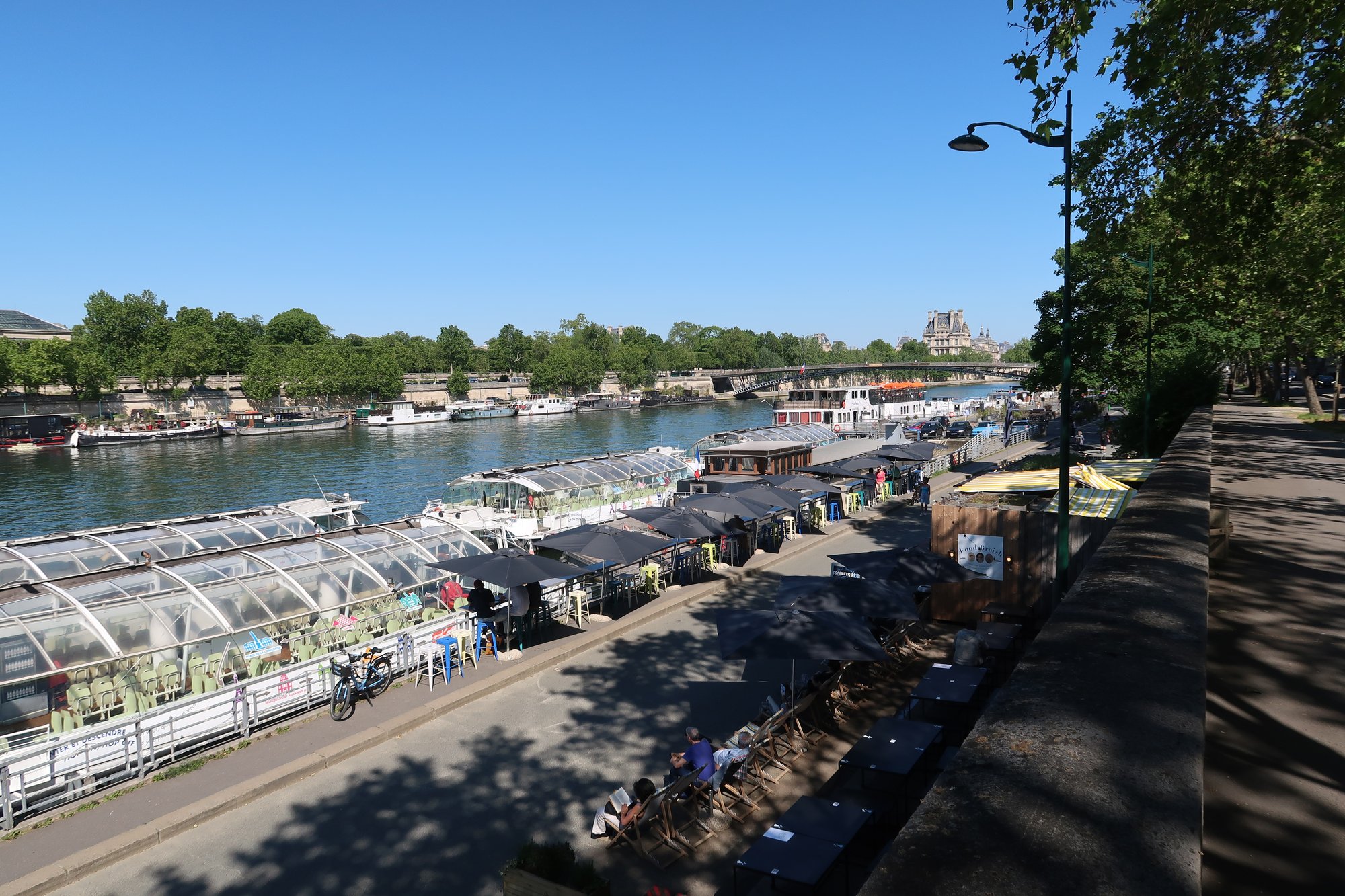
This section is shared between pedestrians and cyclists, but well marked. The surface is excellent. The path runs alongside moored barges, some of which house floating restaurants and bars.
From Pont d’Iéna to Bercy: the final stretch
This is where the route becomes slightly more complex. Between Pont d’Iéna and Pont de l’Alma, the bank occasionally shifts into a “shared path” mode with pedestrians on a narrower pavement. Nothing insurmountable, but you do need to stay alert.
Past the Musée d’Orsay — visible on the far bank — the 7th arrondissement riverbanks feature brand-new surfacing laid during the 2022–2023 works. The path is wide, the markings are clear. Time to pick up the pace.
Between Notre-Dame and Pont de Sully, a little curiosity: the banks dip below road level, into a kind of open-air tunnel. It’s magical. It’s also where the smell of river is strongest after flooding.
From the Île Saint-Louis all the way to Bercy, the route follows the purpose-built cycle quays of the 12th and 13th arrondissements. This final section, less well-known, is often the quietest. The Bercy park riverside provides a pleasant green arrival point, with tables, benches and the occasional food truck at weekends.
Lower Riverbank vs Mixed Sections: an Honest Assessment
| Section | Type | Quality |
|---|---|---|
| Saint-Cloud → Pont de Sèvres | Dedicated lower bank | Excellent |
| Pont de Sèvres → Pont Mirabeau | Shared path + diversions | Decent |
| Pont Mirabeau → Pont d’Iéna | Dedicated lower bank | Excellent |
| Pont d’Iéna → Pont de l’Alma | Mixed pedestrian/cyclist | Good |
| Pont de l’Alma → Pont de Sully | Lower bank or purpose-built quay | Very good |
| Pont de Sully → Bercy | Purpose-built cycle quay | Very good |
The vast majority of the route is perfectly rideable. Interruptions are rare and signposted. No sections cross an expressway or fast road.
Passing Under the Bridges: Passable or Not?
A fair question — and one that’s often poorly documented. The short answer: the majority of the underpasses are passable, with a few caveats.
- Pont de Bir-Hakeim: passable on the lower bank side; surface is a bit uneven after rain, but manageable.
- Pont de Grenelle: passable, but watch out for pedestrian convergence at weekends.
- Pont d’Iéna: easy passage, wide bank.
- Pont de l’Alma: access under the bridge is sometimes closed during high water levels (alert threshold: 3.20 m). Check the Seine water level before heading out if the weather has been erratic.
- Passerelle Debilly: a light footbridge — there’s no underpass as such; you ride alongside it.
As a general rule: if the Seine is running high (following recent weather events), sections of the lower bank may be temporarily closed by the prefecture. The Géovélo app or the City of Paris website allow you to check in real time.
Paris Respire Sundays — and the Crowds
Paris Respire Sundays — introduced in 2002 and progressively extended — close several major routes to motor traffic. For riverbank cyclists, it’s a double-edged sword.
The upside: additional roads closed to cars, meaning more route options. The downside: the whole city comes out by bike (or roller skates, or on foot). The Seine banks on a Sunday morning between 10am and 1pm resemble a cross between a car boot sale and a marathon — packed, cheerful, but not exactly conducive to smooth cycling.
Samir’s advice: avoid Sundays between 10:30am and 1:30pm on the central sections (particularly between the Champ-de-Mars and the Louvre). If you love the festive atmosphere, go for it — it’s an experience in itself. But if you want to make proper progress, head out Sunday morning at 8am, or opt for a Tuesday or Thursday instead.
Best Times for a Smooth Ride
The straight answer:
- Weekdays, 7am–9am: ideal. The banks belong to commuter cyclists. Smooth, fast, enjoyable.
- Weekdays, after 6pm: also good, but heavy return traffic on certain sections (particularly between Notre-Dame and the Musée d’Orsay).
- Weekends, before 9am: the best time to see Paris as if on an empty postcard. Magical.
- Sundays, 10:30am–1:30pm: avoid if you’re after a fluid ride.
- Public holidays in summer: packed. Avoid, or head out at dawn.
Photo Spots Along the Way
A few recommended stops for getting the camera out:
- Passerelle de Sèvres — view over the river with the Saint-Cloud hills in the background.
- Pont Mirabeau — immortalised by Apollinaire. The morning light is perfect.
- Riverbank facing the Eiffel Tower — unmissable. For the best angle: step up onto the low wall on the river side.
- Île aux Cygnes, downstream tip — the little Liberty facing New York… well, facing Issy-les-Moulineaux.
- View from Notre-Dame towards the left bank — accessible from the bank, on the Île de la Cité side.
- Bercy Park, arrival point — the Bercy vineyards with the Seine in the background, early morning.
Variant for Wide Cargo Bikes
Cargo bikes — longtails, box bikes, bakfiets — have become a fixture in Paris over the past few years. This route is broadly compatible, but with a few adjustments.
Points to watch for cargo bikes:
- The underpasses beneath certain bridges have bollards or pylons installed to slow down e-scooters. Critical width: 1.20 m. Most box bikes just squeeze through — check your dimensions beforehand.
- The Pont de Sèvres → Pont Mirabeau section includes a pavement diversion that can feel tight for XXL models.
- Recommended alternative for wider cargo bikes: from Pont de Sèvres, follow the D7 (avenue du Président Kennedy) as far as Pont de Mirabeau instead of staying on the lower bank. Less poetic, but more practical.
- From Notre-Dame to Bercy, the purpose-built quays are wide — no problem for cargo bikes.
If you’re looking for the least stressful cargo route with children, start directly from Pont de Mirabeau (bike parking on the Javel side) and ride through to Bercy. 13 kilometres, almost entirely on a wide riverbank path.
In Summary: Why This Route Is Worth It
From Saint-Cloud to Bercy, this is the great Parisian classic for one simple reason: it delivers on its promises. No nasty surprises, no dangerous sections, no need for GPS at every junction. The Seine guides you. The banks carry you. And Paris reveals itself as it rarely does from the road.
Come early. Come on a weekday if you can. Take a moment to stop at Pont Mirabeau and read the four lines engraved in stone — Sous le pont Mirabeau coule la Seine / Et nos amours. And pedal on.
— Samir K.